OT Maps

Old Testament maps in the graphics section.

Persian Empire

Graphic/Image: 
Image Type: 
Map

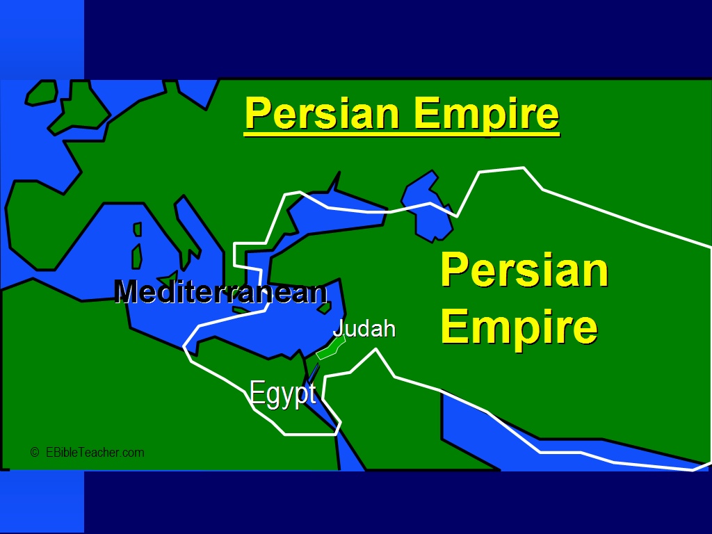
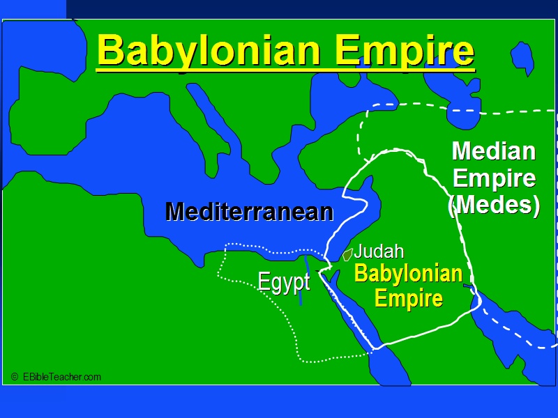
The Persian empire first became prominent about 550 BC when King Cyrus conquered the Babylonian empire. Daniel was in exile in Babylon when the Persians conquered that city. Cyrus allowed many Jews to return to their homeland. Esther became queen to king Xerxes I. The Jews were allowed to take back many temple treasures and rebuild the temple as described in the stories of Exra and Nehemiah. The Persians controlled lands from Egypt to as far as India and as far north as modern day Turkey. They held their empire for about 200 years. In 333 BC, Alexander the great defeated them.

Babylonian Empire

Graphic/Image: 
Image Type: 
Map

Babylon was based in what is now the southern part of the country of Iraq. Babylon was first an important power in about 1850 BC and then later in about 650 BC when they overcame the Assyrian empire. Although the oldest known alphabet comes from the Canaanites, the oldest known writing comes from the Babylonians.

Assyrian Empire

Graphic/Image: 
Image Type: 
Map

Assyria was based in what is now the northern part of Iraq. The Assyrian empire became an important empire between 1500 and 1100 BC and lasted until conquered by Babylon in about 600 BC. A few hundred years later the Assyrian empire came and overwhelmed the Israelite nation. The Assyrians liked to take large numbers of the conquered people back to other parts of the empire and then replacing them with people from other countries. That this happened in 2Kings 17:6, 24+ and 2Kings 18:31-32. Tiglath-pileser III conquered Israel and oppressed Judah. Judah was made to pay tribute.

Divided Kingdom

Graphic/Image: 
Image Type: 
Map

After Solomon's reign his kingdom was divided into two parts.

Herod's Temple

Graphic/Image: 
Image Type: 
Map

A graphic map of Herod's Temple, including the many courts and out-buildings mentioned in the Bible.

Solomon's Temple

Graphic/Image: 
Image Type: 
Map

Tabernacle 3

Graphic/Image: 
Image Type: 
Map

Just inside the outer wall door was the altar of burnt offering which was made of wood overlaid with bronze. The alter was about 7.5 feet square (2.5 meters). Next came the laver which was a large bronze basin used by the priests to wash before entering the tabernacle. The Tabernacle tent itself was over a frame of acacia wood. The wood was overlaid with gold which created two golden walled rooms within the tent.

Tabernacle 2

Graphic/Image: 
Image Type: 
Map

ISRAELITE CAMP AND TABERNACLE SCHEMATIC: This slide shows how the Tabernacle occupied a position at the center of the camp with the 12 tribes of Israel arranged in specific locations around the Tabernacle. There were three tribes camped at each point of the compass around the Tabernacle. The Levites occupied a camp immediately surrounding the Tabernacle.

Tabernacle 1

Graphic/Image: 
Image Type: 
Map

The Tabernacle outer wall surrounding the courtyard was about 150 by 75 feet or about 50 by 25 meters. (An American football field is 300 by 75 feet). The outer linen wall was held up by wooden posts with bronze bases and silver tops. The linen was white except at the entrance door which was purple and blue and scarlet colors. Just inside the outer wall door was the altar of burnt offering which was made of wood overlaid with bronze. The alter was about 7.5 feet square (2.5 meters). Next came the laver which was a large bronze basin used by the priests to wash before entering the tabernacle.

Solomon's Israel

Graphic/Image: 
Image Type: 
Map

Solomon's Israel was the period in which Israel was at its greatest. Solomon's Israel was so large that it can’t all be shown on this NASA photo.

Syndicate content